Aythya fuligula – HWYADEN GOPOG – Winter visitor and passage migrant. Has bred.
Year
Notes
1988
An agitated pair at Lower Treginnis on 19 June was suspected of having a hidden brood.
1992
A brood of 5 at Maryborough, Dale, was produced by a pinioned duck which had presumably mated with a wild drake – first Pembrokeshire breeding record
1993
Male Marloes Mere 1 June, and a pair at Clarydale Water in July, but no evidence of breeding
1996
Pair remained at Marloes Mere and were seen with brood 24 June (BP, JPB) but they did not fledge. This is the first natural breeding record for Pembs. (Donovan & Rees 1994)
1997
All had departed by late April save a pair at Marloes Mere which hatched 5 and fledged at least 2 young.
1999
Pair fledged 2 young at Marloes Mere
2001
No evidence of breeding this year but daily fluctuations at Skomer (max 11) and Marloes Mere (max 13) indicated passage throughout May into June.
2004
3-9 Marloes Mere Mar- 29 May and 1-7; Skomer , 2 Apr – 23 June (no evidence of breeding)
2005
Two pairs attempted to breed Skomer, with a brood of 5 seen 1 July but probably did not survive.
2006
Two pairs attempted to breed Skomer, with a brood of 7 seen 15 June but none fledged
2007
A pair bred on Skomer, with a mother and 4 chicks seen on Green Pond on 22 June, but had lost them all by the 26th.
2008
A pair bred on Skomer and hatched 6 young that were seen on June 11 & 12, but not subsequently. This seems to be a regular occurrence, unfortunately.
2014
A pair seen at Rosebush Resovoir in June prompted thoughts of possible breeding but no evidence was seen subsequently.
red = confirmed breeding; yellow = probable breeding
1984-88
2003-07
Breeding confirmed
40
37
Breeding probable
9
6
Breeding possible
17
10
No of tetrads occupied
66 (of 478)
53 (of 490)
Percentage of tetrads
13.8%
10.8%
Choughs, with their bright red legs and a red down-curved bill, are the rarest member of the crow family in Britain. Their population is mainly limited to cliff-coasts on the western seaboard of the UK and Ireland.
In Pembrokeshire they nest entirely in natural coastal cliff-crevices, and feed mainly in short-cropped (< 3 cm) maritime grassland swards, heath and dunes, but also utilise semi-improved pasture. Interfaces between vegetation, bare ground and rocky terrain are particularly important feeding areas. Choughs feed on soil invertebrates, such as leatherjackets, beetle larvae, ants and their larvae. In autumn and winter they will also occasionally take spilled cereal grain in coastal stubble fields.
Pairs often mate for life and adults can live for 10 or more years. Sexual maturity can occur at two years old, but breeding success is more likely when three or more years old. Adult pairs occupy a territory; though will occasionally join more mobile flocks of non-breeding one to three year old birds.
Choughs have been well studied in Pembrokeshire, with annual population assessments since the 1990s; summary details being published in annual Pembrokeshire Bird Reports. Since 1963 they have also been the subject of national surveys approximately every ten years.
Records from tetrads suggest a decline in the overall distribution of Choughs between 1984-88 and 2003-07. However more detailed recording of the breeding population across the county suggests it has increased. This highlights some of the difficulties in recording this species at the tetrad level to try to determine changes in the whole population level. They are thinly spread in some tetrads but nest at higher density in other tetrads where there are key areas supporting optimal feeding and nesting habitat.
Donovan and Rees (1994) considered that the Chough population was probably stable in the 20th Century but periods of severe weather caused temporary decreases. Decadal surveys in 1982 and 1992, registered a minimum of 51 and 58 pairs respectively. In the most recent national survey, 2002, the population had risen to approximately 62 territory holding pairs.
During the first decade of the 21st Century the population does appear to have increased slightly, possibly helped by a run of relatively mild winters and by positive management stemming from a “Pembrokeshire Chough Conservation Strategy “. This has included coastal grazing initiatives and management of recreational activities. By 2007, the number of pairs occupying territories had increased to 72, the highest recorded in Pembrokeshire. See Figure below.
Key areas for Choughs include Ramsey and St David’s peninsula, Castlemartin coast and Skomer, which are all within Special Protection Areas which form part of the Natura 2000 series of sites of European Importance. Breeding Chough populations in these areas are monitored regularly, together with surveillance of the non-breeding population.
From 1993 a small number of Chough nestlings were colour – ringed each year along the Castlemartin coast and on Ramsey. This study has provided details about movements between breeding territories and survival (Haycock, 2002).
A small band of dedicated volunteers undertook annual recording, obtaining key local knowledge of their particular “patch”. Visitors have also provided valuable records and colour–ring sightings.
Bob Haycock (BTO rep & Chairman of the Pembs Bird Group)
HAYCOCK. R.J, 2002. Pembrokeshire Chough Study Group chough colour-ringing project: preliminary observations and a plea for more resightings! Pembrokeshire Bird Report 2001 pp 37-43. Wildlife Trust South and West Wales.
The Pembrokeshire Breeding Bird Atlas 2003-07 provided an update to the 1994 Birds of Pembrokeshire, covering the breeding species only.
THE MAKING OF THE ATLAS
Introduction
The county of Pembrokeshire is some 158,000 hectares (613 square miles) in extent, with its southern, western and northern boundaries all coastal. The climate is maritime, with strong oceanic influences found also in the type and distribution of fauna and flora.
A review of all the species of birds recorded in the county in all seasons is to be found in the “Birds of Pembrokeshire” by Jack Donovan and Graham Rees, published in 1994 and including a breeding bird atlas based on fieldwork done in 1984-88. This important publication provided a baseline on which to compare mapped distributions and population estimates of different species within the county.
The populations of any animals that can walk, fly, swim or crawl will change in numbers and distribution over a period of time, so that any atlas will become out of date over a period of years, decades or centuries.
Biodiversity is the buzzword, and the need to know what species are where has become important, indeed a requirement, for planning and conservation purposes.
Trends towards milder and windier winters, and towards cloudier, wetter summers, may herald longer term climate change. But there is already anecdotal evidence, as well as indications from country-wide surveys, that there are other changes happening in the natural world.
At a local level, it was decided that the “Birds of Pembrokeshire” should be updated. This breeding birds atlas is first stage in that process. It does, indeed, show that there have been changes, both losses and gains, within the 15 to 20 years between the two fieldwork periods
Methodology
On the 2nd September 2002 the Pembrokeshire Bird Group convened a meeting at “The Patch”, Furzey Park, Haverfordwest, to discuss the desirability of producing a new avifauna for Pembrokeshire. All interested parties were invited to attend and those interested but unable to attend were encouraged to communicate their views.
The meeting agreed to go ahead with such a project and that it should encompass a breeding birds survey using a tetrad (2km x 2km) grid. To this end an Avifauna Committee was elected, comprised of Graham Rees (chair), Annie and Bob Haycock, Jane Hodges, Trevor Price, and Mike Young-Powell.
At their first meeting, the committee decided that the breeding survey should be the first aspect to be addressed. It was to run from 2003 to 2007 and to take the same form as the 1984-88 survey so that the two would be directly comparable. The 1984-88 survey was the first in the county to use as fine a scale as the tetrad grid. It was also the first attempt made to estimate the size of the breeding population of each species in the county.
Recording forms and accompanying instructions were printed and distributed in time for field work to begin in 2003.
Data from completed recording forms, representing some 30,000 records from 490 tetrads, were entered on computer by a small team comprising John and Marion Best, Annie and Bob Haycock, Fiona and Trevor Price, using the computer software package MapMate. A summary of the records from the 1984-88 survey was similarly entered, so that comparable maps could be generated.
The methods used for atlas fieldwork followed those of The Atlas of Breeding Birds in Britain and Ireland (Sharrock 1976) but recorded at the tetrad level rather than hectad (10km x 10km) level. For our local atlas however, adjustments have been made in as much as the islands of Grassholm, Caldey, Skokholm and Ramsey have been regarded as occupying one tetrad each, while Skomer and Middleholm have been treated as a composite tetrad. As in that first national atlas, the final maps are populated with small dots to indicate that a species was present during the breeding season, medium-sized dots to show that it probably bred, and large dots to show that breeding was confirmed, as shown in figure 1:
The example map above shows the data entry record card in MapMate that helps generate distribution maps. Records entered this way gradually build up a growing series of distribution dots on a map, Each record entered represents a breeding registration for a particular species in a particular tetrad. The species in this case is House Martin and the tetrad is SN04L (SN0442 Trwyn y Bwa).
The more visits that are made to a particular tetrad, the more information there is behind each dot providing an eventual final outcome – in this case the largest dot showing confirmed breeding. In other tetrads medium dots represent probable breeding (e.g. bird showing territorial behaviour or visiting potential nest site, and probably went on to breed successfully) while the small dots show that the species was present in a tetrad at some time during the survey, but no evidence was found to indicate that it was doing more than feeding or resting there.
Another team of volunteers, comprising Graham Rees, Bob Haycock, Jane Hodges, Steve Sutcliffe, Paddy Jenks and Richard Dobbins wrote the individual species accounts. Annie Haycock then assembled the maps and texts into this volume.
The map below shows the tetrads covered in the 1984-88 atlas (in yellow) and 12 extra tetrads (blue dots) covered during the 2003-07 period. These were all peripheral tetrads, either coastal or along the county boundary, and including only a small amount of land.
Population estimates
The 2003-07 Pembrokeshire breeding survey was deliberately undertaken using the same methodology as the previous 1984-88 survey, so that the two were directly comparable. It should, therefore prove useful in assessing biodiversity, species distribution changes and perhaps in evaluating the effects of changes in weather patterns over the period.
However, there are limitations to the information gathered by this kind of survey. It is basically a presence or absence survey, with some additional value in terms of proving whether or not species was breeding throughout the area. Nonetheless, it does give a reasonable indication of the spatial distribution of each species, and whether a species is localised, is widespread occurring in most tetrads, or is widespread but scattered.
The results take no account of time spent in the field in each tetrad, or of observer bias or competence. Figure 2 shows the number of species recorded in each tetrad in each atlas period (all species are included, whether or not they showed signs of breeding). In the later period there appears to have been a shift away from the north, with more species recorded in the south-east and on the St. David’s peninsula. While some of this shift may be genuine, some of it is likely to be observer bias as people inevitably record closer to their home areas unless directed to do otherwise.
People were not asked to count birds whilst recording in tetrads during the main 2003-07 survey. The limited population data collected as part of the BAP breeding survey applied to nature reserves and other special areas, and so was not directly applicable to the county as a whole.
For the 1984-88 atlas, population estimates were compiled from survey results combined with extensive personal experience (of the authors) within the county (Donovan & Rees 1994). These estimates provided a baseline used to inform population estimates for the 2003-07 atlas. For example, an increase in the number of tetrads recorded for a species was assumed to have the same proportional increase in population. For a few species, e.g. Yellowhammer, anecdotal evidence indicated that has there has been a thinning out of the population, while for others, such as Chough, long term surveillance of nest sites showed there has been an increase in the breeding density, at least in some areas. This approach therefore has limitations.
It will be noticed in the accounts for many species, that the results of the 1988-91 National Atlas (Gibbons et al) have been used in testing the original estimates made following the pioneering 1984-88 local atlas. For a few species, this has resulted in a revision of the original local population estimate and is explained in the individual species text.
The BTO/JNCC/RSPB Breeding Bird Survey (BBS), which came into being in 1994, also provides a useful tool for estimating populations. This survey is carried out nationally, and provides indices of the populations of birds in Britain in summer. These indices are based on both the changes in numbers of each species counted along two parallel 1km transects in a 1km square, and on changes in the percentage of squares in which they occur.
For most species in this atlas, a new population size has been estimated, based on a combination of data from the 1984-88 fieldwork, the 2003-07 distribution maps, the results from the 1988-91 National Atlas, and the BBS indices for Wales. The current National Atlas (fieldwork in progress at the time of this publication), backed by extensive information from other bird research and survey, will undoubtedly become useful in further refining these population estimates in due course. This new information will be considered in the more comprehensive Pembrokeshire Avifauna.
For other species, notably seabirds, chough and peregrine, more specific data are collected annually and this allows a more detailed assessment of population size to be made. Seabirds on the Islands and the Castlemartin coast are counted annually for the Seabird Monitoring Programme administered by the JNCC (www.jncc.gov.uk/page-1550). For all these species, there is more discussion about the population changes in the species accounts.
Density of recorded species in each atlas period
1984-88 density map. The smallest dots represent 2 species, the largest represent 86 species. The counts include non-breeding species.
2003-07 density map. The smallest dots represent 2 species, the largest represent 81 species. The counts include non-breeding species.
The average number of species per tetrad is 35.
INTERPRETING THE SPECIES ACCOUNTS
For those species of particular conservation concern, the designation of red or amber-listing, or UK BAP or LBAP is given in the title line. Further information about these designations is given in appendix III.
A brief introduction is given for each species, followed by comments about changes in distribution and population, and a discussion of problems with calculating such changes.
Maps are not reproduced for all species, where the breeding distribution is so limited that it can readily be expressed in the text, e.g. Gannet. For some scarcer and legally protected (Schedule I of the Wildlife and Countryside Act) species, maps are provided at a 10 kilometre square level.
For the majority of species, a table shows the total number of tetrads in which the species was found, plus the numbers of tetrads that registered “confirmed”, “probable” or “possible” breeding during each atlas period. Note that for some species, for example rooks and other colonial nesting species, birds foraging in fields or in flight do not give any indication of the location of their nest sites, which may be some distance away, and therefore such “possible” breeding records have been excluded. For other species, for example skylark, the distribution was based largely on birds singing on more than one date in the same place to show they are holding territory. In these instances the maps show mostly probable breeding.
GIBBONS. D. W, REID. J. B, CHAPMAN. R. A. 1993. The New Atlas of Breeding Birds in Britain and Ireland, 1988 – 1991, T & A. D. Poyser
SHARROCK, J.T.R. (1976) The Atlas of Breeding Birds in Britain and Ireland. T. & A.D. Poyser
Greylags have been a regular winter visitors to the county since 1972, and are thought to be derived from feral populations. Today, the Greylag Goose is a naturalised resident in Pembrokeshire throughout the year, and breeding was confirmed during the 2003-07 survey.
As shown on the tetrad map, all the records were obtained in tetrads in the vicinity of the Eastern Cleddau, Slebech/Canaston area, or between the Eastern Cleddau and the Carmarthenshire border. It seems likely that the small breeding population that is becoming established in this part of Pembrokeshire is derived from a feral population that was originally introduced by wildfowlers in the Kidwelly area, Carmarthenshire.
The breeding population is small, and is not thought to more than 3-6 pairs. Greylag Geese are, however, opportunistic colonisers, utilising farm reservoirs and large ponds with islands as nest sites, with grazing close-by. Limiting factors on future range expansion are likely to include availability of suitable nest sites, an ultimately finite resource over which Greylag Geese could conceivably come into competition with a rapidly expanding Canada Goose population.
Largely introduced into Pembrokeshire to grace ornamental waters, the mute swan has now become naturalised. Habitat requirement is for a supply of aquatic plants, sufficient room to be able to take off and a suitable bank or reed bed in which to place its bulky nest. Formerly nesting on saltings, this practice had ceased by the time of the 1984-88 survey. During the 2003-07 survey they had reoccupied this niche at Cosheston Pill, the Haroldston region of the Western Cleddau and the tidal upper limit of the Eastern Cleddau. Otherwise all nests were found on fresh waters.
Ten pairs were breeding in the county during the 1984-88 survey, 22 breeding pairs were found during the 2003-07 survey. The increase was accompanied by an expansion in distribution to the east and an increase in the number of pairs in the south of the county, particularly at Pembroke Mill Ponds.
Graham Rees. Pembrokeshire County Bird Recorder 1981-2007
Canada geese were introduced into Pembrokeshire in 1955, at Boulston, on the Western Cleddau and in 1957 at Orielton, where they continued to breed until 1977. The Boulston group became well established, with 30 geese present in 1968, 78 in 1971 and 159 in 1986. Pairs bred at Haroldston West and on Sheep Island in 1976, although at this time, the population was still generally confined to the upper Daugleddau Estuary, which they seldom left. Between the 1984-88 and 2003-07 tetrad surveys the Canada goose population underwent a significant expansion in range, as shown on the tetrad map.
The tetrad map for 2003-07 shows that as a breeding species, Canada geese are now widely spread across the county. They are opportunistic colonisers and breeding pairs have become established on farm irrigation reservoirs and large ponds with nesting islands and grazing close-by. Breeding pairs have also taken up residence on some of the small rocky islets off the mainland coast of Pembrokeshire, as well as on the islands of Skokholm and Skomer.
In 2003-07, breeding was confirmed in 52 mainland tetrads. Assuming a nesting density of at least one pair per tetrad, and taking into account the 16 pairs on the two islands, the breeding population in 2007 was at least 68 pairs, and may have been closer to 100 pairs.
In Pembrokeshire, Shelducks are strongly associated with estuaries, in particular the Milford Haven Waterway and Daugleddau Estuary, and its associated embayments and tributaries. In the 1984-88 survey, breeding Shelducks were also recorded on the Teifi Estuary, and on Caldey Island.
A comparison between the 1984-88 and 2003-07 breeding surveys reveals changes in the distribution of breeding Shelducks in the county, as shown on the tetrad maps.
Some of the more significant changes include the disappearance of Shelducks as a breeding species from the southern side of the outer Milford Haven Waterway, e.g. in Angle Bay/Kilpaison, and from coastal sites such as in the Freshwater West area. There have also been gains, with Shelducks breeding on Skomer and Skokholm Islands and on the Nevern Estuary. Breeding Shelducks were also present on the Teifi Estuary. The number of tetrads in which Shelducks were recorded as confirmed or probable breeding had also increased by 2003-07, from 31 to 36, with possible breeding recorded in a further 14 tetrads.
One or two of the records of possible breeding on the exposed open coast need to be treated with caution. Pairs and small groups of Shelducks are a common occurrence on the open coast in May and June, either resting on the surface of the sea, or on the cliffs above (J. E. Hodges, pers. obs.).
Some of these birds may well be non-breeders en-route to moult grounds. Moult migration in Shelducks is well-defined. First and second year birds leave for the moult grounds from May onwards, to be followed by non-breeding adults or failed breeders later in June and early Jul. By mid-July all non-breeding Shelducks, together with adults that are not minding ducklings, have left the Milford Haven Waterway and Daugleddau Estuary for the moult grounds (Hodges, 1992-2008).
Following the 1984-88 survey, the breeding population of Shelducks in the county was estimated to be around 50 pairs. In the period 2003-07, the numbers and sizes of broods of ducklings seen in the Milford Haven Waterway & Daugleddau Estuary varied each year, from 10 to 22 broods. In addition, several territorial males and pairs without broods (but which may have attempted to breed) were recorded in each of the five seasons. Taking into account the breeding pairs on the islands; in the Newport area and on the Teifi Estuary, together with pairs scattered around the county, 60 – 70 breeding pairs might be a reasonable population estimate.
Caution should, however be exercised, since Shelducks are known to “dump-nest”, whereby females lay their eggs in another female’s nest, leaving the owner of the nest to incubate the eggs and lead the newly hatched ducklings to water along with their own ducklings. “Dump-nesting” is sometimes indicated by large broods, e.g. of nine ducklings or more, and almost certainly occurs amongst the Shelduck population in Pembrokeshire.
Anas crecca – CORHWYADEN – Common winter visitor, passage migrant and scarce breeder
Historically the teal has only sporadically bred in Pembrokeshire. It was found breeding at just one locality during the 1984-88 survey. None were found nesting during the survey of 2003-07, although there was a single record of a bird displaying at Marloes Mere.
Graham Rees. Pembrokeshire County Bird Recorder 1981-2007
In the breeding season gadwall favour lowland, shallow, eutrophic waters. They were suspected of attempted breeding at Marloes Mere from 1996 but it was not proven. Breeding was confirmed at Skomer in 2000, 2001 and 2004, the latter during the 2003-07 survey, when they also probably bred at Bosherston, though no ducklings were seen.
Graham Rees. Pembrokeshire County Bird Recorder 1981-2007
Note: the 2004 Pembrokeshire Bird Report states that: Pair hatched 9 young at Skomer 18 May, surviving until at least 14 June, when they disappeared with their mother.
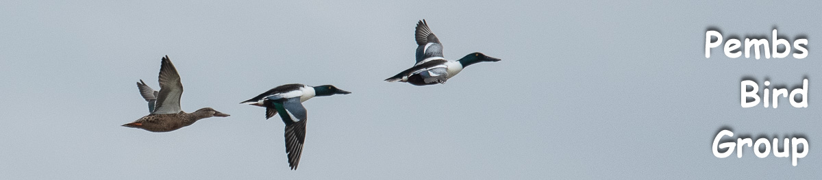
Shoveler have nested at several localities in the county in the past but in the last twenty years seem to have become confined to three places. During the 1984-88 survey breeding was confirmed at Skomer and Marloes Mere. The 2003-07 survey found confirmed nesting at Skomer and probable breeding at Skokholm and Marloes Mere.
Graham Rees. Pembrokeshire County Bird Recorder 1981-2007


 1984-88 density map. The smallest dots represent 2 species, the largest represent 86 species. The counts include non-breeding species.
 2003-07 density map. The smallest dots represent 2 species, the largest represent 81 species. The counts include non-breeding species.


